On-site check-in/check-out for field service teams

Field service visits work best when techs see exactly what to do—and you capture exactly what happened on every on-site visit. These screenshots show a lightweight, end-to-end mobile check-in/check-out flow that keeps instructions, usage, notes, and proof of service tied to each field visit. With Mapsly, the same service record that appears on the route map becomes the source of truth on the phone: one place to view customer context, perform the work, add photos, and write everything back to the CRM without extra apps or manual uploads.
Tree delivery & planting route planning solution

Landscaping teams thrive on clear coverage, clean schedules, and tight handoffs. Mapsly brings tree delivery route planning and on-site planting reporting into one flow—so trees arrive on time and crews capture what really happened. Supervisors see territories, priorities, and status in a single operational view, while routes respect availability windows, visit duration, working hours, breaks, start/finish locations, and vehicle capacity. The result is predictable days, fewer callbacks, and a smoother customer experience from yard to job site.
Month-long routing at scale: 30+ reps, 2,000+ locations
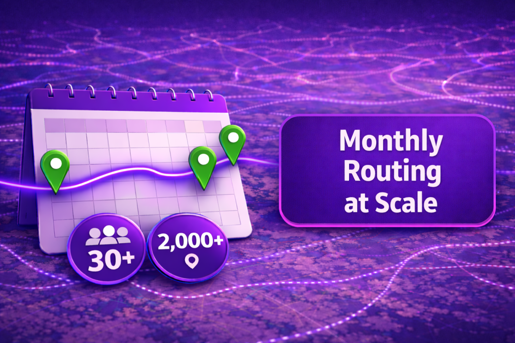
When your field program spans dozens of people and thousands of stops, manual planning isn’t just slow—it’s impossible. Mapsly’s Regular Visit Planner automates a full month of routes across large teams, using a smart algorithm that respects each store’s visit frequency while factoring visit duration, rep working hours, store opening hours, holidays, territories, skills, buffers, and more.
Long-haul pickup & delivery planning in Mapsly
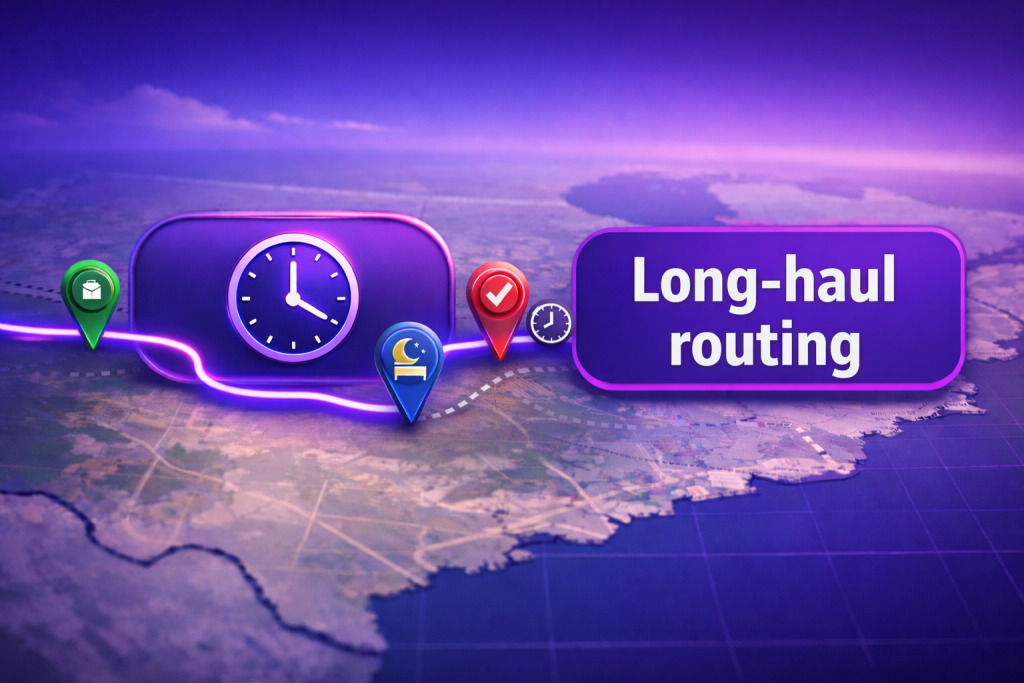
Cross-country pickup & delivery gets complex fast—tight timing, long distances, border crossings, overnight layovers. Mapsly plans long-haul routes that respect strict pickup/delivery windows, maximum transit durations, and real-world constraints while keeping customers informed.
Find 3× more ICP leads with Mapsly Prospecting + API data enrichment

Turn any map view into a list of call-ready ICP leads. Mapsly helps teams discover businesses directly on the map, enrich prospects through approved data enrichment APIs, and save the results back to your CRM in one pass. Organizers keep a single operational view—search, refine, enrich, and save—so B2B prospecting stays focused on the right titles and departments without spreadsheet hops or manual copy-paste.
County-based territories & demographic targeting for medtech sales
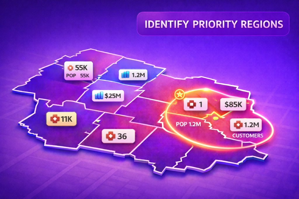
Selling medical devices to clinics is a location game. With Mapsly, a medtech sales team can build county-based sales territories, overlay demographic data like mean income and population, and compare them with the count of existing clinic customers to spot true whitespace. Leaders get a single operational view that blends territory boundaries, rollup metrics, and live CRM records—so territory strategy and field coverage decisions come from the map, not spreadsheets.
Custom map tiles and territory assignment
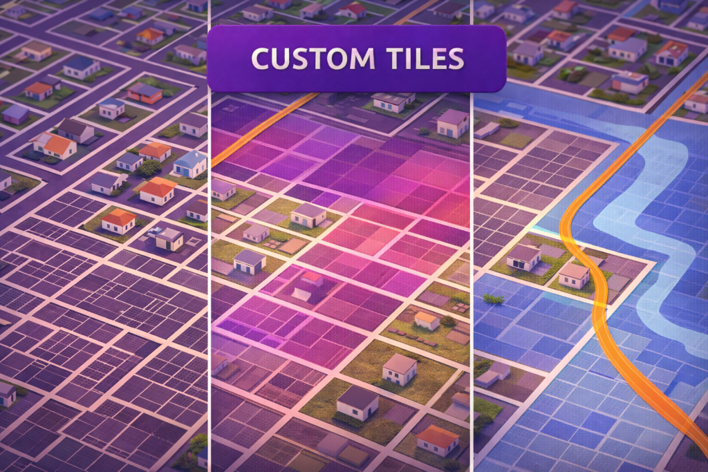
Many datasets live outside your CRM—parcel boundaries, zoning, flood zones, utility corridors. With Mapsly, you can connect a Mapbox custom tileset and render custom map tiles alongside your CRM data so reps, ops, and planners see parcel context and customer context on the same map. The result is a single operational view where location layers, territories, and live CRM records come together for faster decisions and cleaner handoffs between teams.
Sales territory balancing on a map
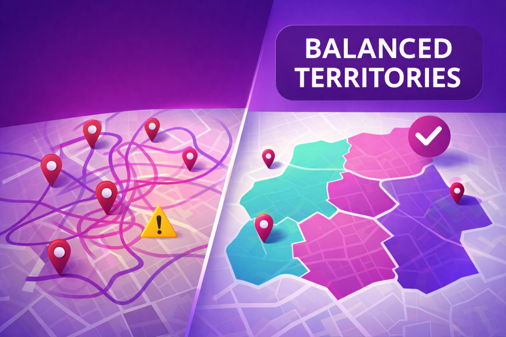
Sales teams perform best when territories are fair, focused, and easy to manage. Mapsly helps revenue leaders balance sales territories by visualizing workload, analyzing roll-up metrics, and reassigning territory boundaries with confidence—all directly on the map. Instead of spreadsheets and guesswork, you get one operational view of sales territory maps, live account and pipeline totals, and clear signals on where capacity is stretched or coverage is thin, so territory changes are grounded in data and visible to everyone.