Weather Map
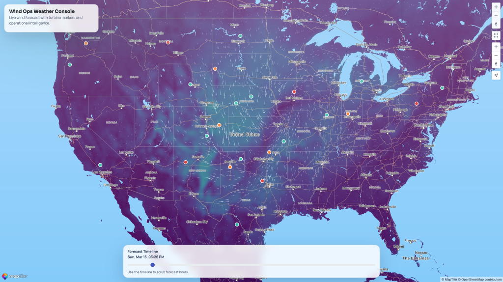
Weather Map combines live wind forecasts with turbine markers and operational status cues so teams can watch weather risk and asset conditions in one place.
Disaster Response Liveboard
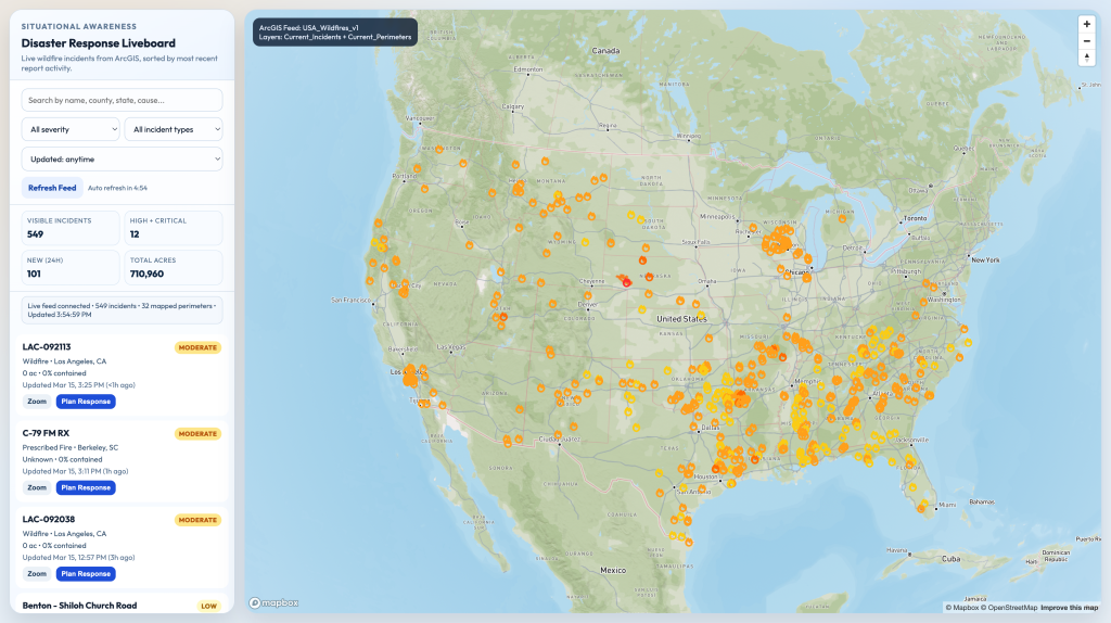
Disaster Response Liveboard pulls live wildfire incidents from ArcGIS, ranks severity, and includes a built-in response planner for dispatching field teams. It is a strong public-safety showcase for live incident awareness.
Wind Inspection App
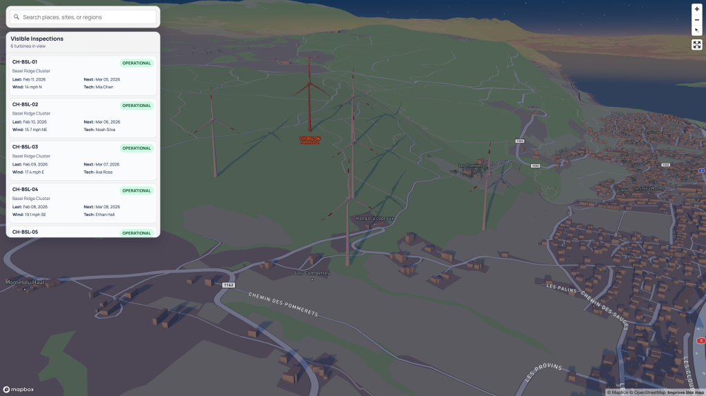
Wind Inspection App combines turbine status mapping with an inspection queue and a structured field form for telemetry, photos, and compliance notes. It fits wind service teams that need better visibility and documentation.