County-based territories & demographic targeting for medtech sales
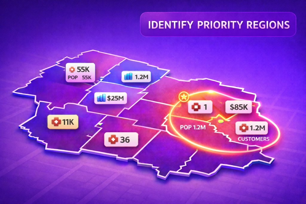
Selling medical devices to clinics is a location game. With Mapsly, a medtech sales team can build county-based sales territories, overlay demographic data like mean income and population, and compare them with the count of existing clinic customers to spot true whitespace. Leaders get a single operational view that blends territory boundaries, rollup metrics, and live CRM records—so territory strategy and field coverage decisions come from the map, not spreadsheets.
Custom map tiles and territory assignment
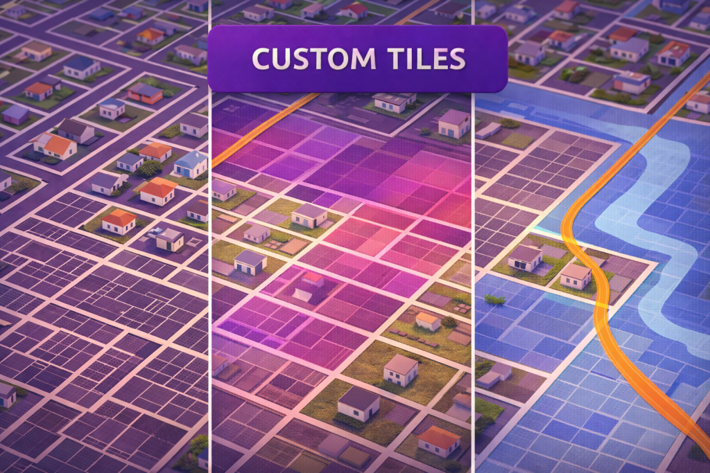
Many datasets live outside your CRM—parcel boundaries, zoning, flood zones, utility corridors. With Mapsly, you can connect a Mapbox custom tileset and render custom map tiles alongside your CRM data so reps, ops, and planners see parcel context and customer context on the same map. The result is a single operational view where location layers, territories, and live CRM records come together for faster decisions and cleaner handoffs between teams.
Sales territory balancing on a map
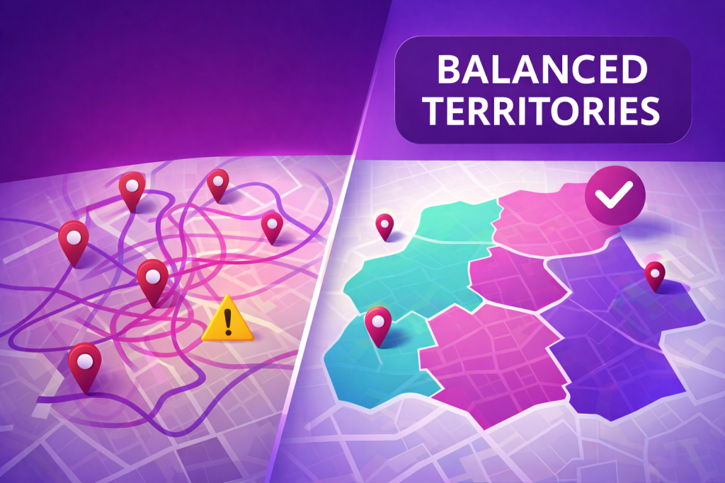
Sales teams perform best when territories are fair, focused, and easy to manage. Mapsly helps revenue leaders balance sales territories by visualizing workload, analyzing roll-up metrics, and reassigning territory boundaries with confidence—all directly on the map. Instead of spreadsheets and guesswork, you get one operational view of sales territory maps, live account and pipeline totals, and clear signals on where capacity is stretched or coverage is thin, so territory changes are grounded in data and visible to everyone.
Helping Save Smiles: How the Tooth Rescue Project Uses Mapsly to Support Emergency Dental Care Across Germany
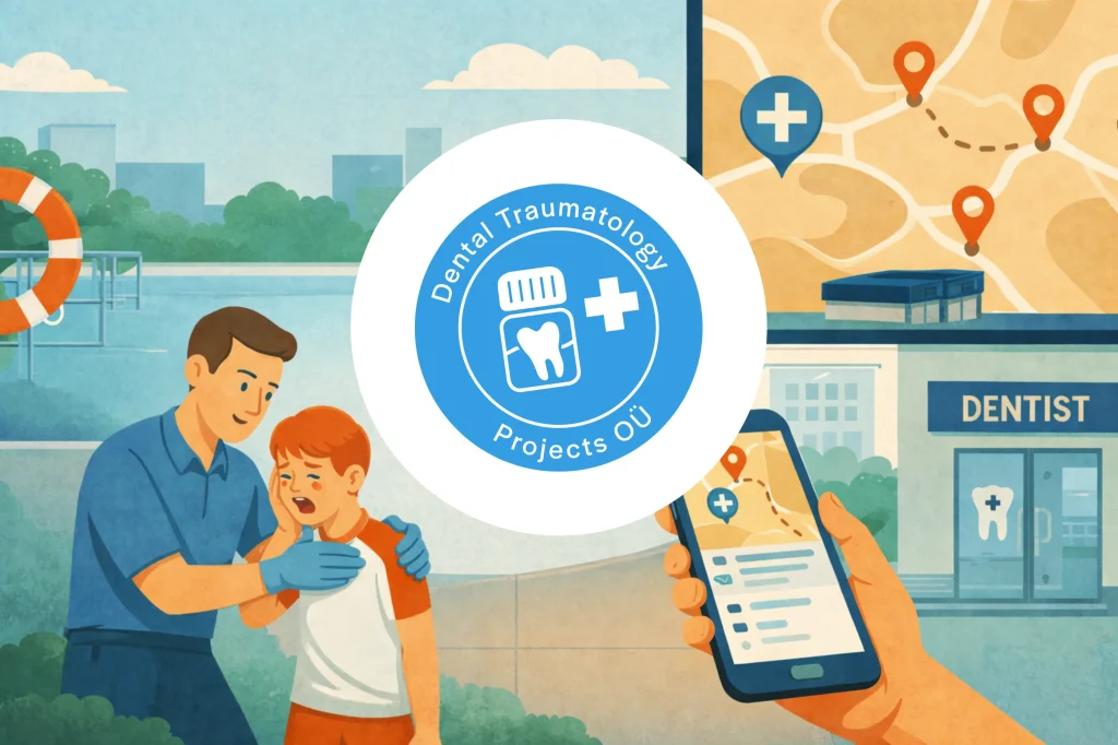
Dental Traumatology Projects brought lifesaving emergency dental care to life mapping 113,000+ Tooth Rescue Box locations and nearby dentists into instantly shareable town-level views that replace clunky spreadsheets and help save smiles in seconds.
From Maps to Momentum: How a 12-person Field Team Cut Route Planning from Hours to Minutes with Mapsly

Cisolift’s 12-person field team slashed daily route planning from 1–2 hours to 10–15 minutes with Mapsly’s HubSpot integration, optimized routing, and on-the-fly prospect discovery—turning prep time into selling time.
Agrifac × Mapsly: Bringing order (and a live map) to a 20,000-account universe

Agrifac mapped 20,000 accounts in Zoho CRM with Mapsly, cutting hours of manual route planning and giving 30 field reps live visibility into customers, dealers, and open opportunities—all from one synced map.
Field Service, Simplified: How a Small Lawn Care Team Built a Scalable System with Mapsly

Sommer Lawn & Landscape has significantly reduced routing time, improved scheduling accuracy, and created a smoother experience for both team and clients.
BeaverTails Cuts Booking Errors to 1% and Simplifies Franchise Management with Mapsly

Canadian dessert franchise BeaverTails uses Mapsly to automate food truck bookings, streamline territory planning, and manage operations across 90 franchisees — all from one map.
Beating the Benchmarks: Mainstream Fiber’s Field Team Leveled Up with Mapsly Smart Mapping and Real-Time Visibility

Territory control, real-time routing, and rep visibility turned field sales into the top channel.
How City Larder Streamlined Prospecting, Territory Management, and Delivery Planning with Mapsly

By integrating Mapsly’s advanced mapping, prospecting, and automation tools with HubSpot, City Larder saved hours of manual work, standardized their operations, and prepared their growing business for scalable field sales and delivery management.