




Airtable이 지도에서 할 수 있는 것과 할 수 없는 것
Airtable의 네이티브, 지도 확장 프로그램 레코드를 핀으로 표시합니다. 주소 또는 좌표가 있는 필드를 지정하고, 자체 Google Maps API 키를 추가하면, 지오코딩을 수행하고 위치를 클릭 가능한 핀으로 표시합니다, 몇 가지 마커 스타일 옵션과 함께.
하지만 가능한 것은 거기까지입니다. 기본 지도 보기는 표시 전용입니다: 경로를 최적화하거나, 여러 날 또는 여러 사용자의 출장 일정을 계획하거나, 구역을 관리하거나, 모바일 현장 앱을 구동할 수 없습니다. 또한 base에 어떤 내용도 다시 기록하지 않습니다. 실제로 해당 위치로 이동하는 팀에게 지도에 핀을 꽂는 것은 쉬운 부분입니다. 어려운 부분은 그다음에 이어지는 모든 것입니다.
여기서 네이티브 확장 기능의 역할은 끝나고, Mapsly와 같은 도구가 이어받습니다:
| 기능 | Airtable 네이티브 지도 확장 기능 | Airtable + Mapsly |
|---|---|---|
| 지도에 레코드 표시 | 예 | 예 |
| 주소 지오코딩 | 수동, 본인의 Google Maps API 키 필요 | 자동: 주소 정리, 누락된 우편번호/카운티 입력 |
| 최적화된 다중 경유지 경로 설정 | 아니요 | 예 |
| 여러 날 & 다중 사용자 계획 | 아니요 | 예 |
| 자동차, 트럭, 자전거 & 도보 모드 | 아니요 | 예, 트럭 제한 포함 |
| 권역 관리 & 자동 배정 | 아니요 | 예 |
| 노코드 자동화 | 아니요 | 예 |
| check-in 기능이 있는 모바일 앱 | 아니요 | 예 |
| 귀하의 베이스와 실시간 동기화 | 보기 전용 | 예, 실시간 |
Airtable 레코드를 실시간 지도 보기에서 확인하세요,
Mapsly는 Airtable 베이스의 대화형 지도 보기를 제공하며, 자체 API 키가 필요하지 않습니다. 주소나 좌표가 있는 모든 레코드는 핀이 됩니다.
필터링하고 색상으로 구분합니다. Airtable의 모든 필드로 핀 스타일 지정: 상태, 소유자, 우선순위, 거래 규모, 서비스 유형.
제자리에서 편집. 지도 팝업에서 레코드를 바로 업데이트하거나, 테이블 보기에서 일괄 업데이트하세요.
권역을 그립니다. 지역을 스케치하거나 가져오고, 각 지역 안에 포함되는 레코드를 확인하세요.
컨텍스트 추가. US Census를 포함한 인구통계 및 위치 데이터를 오버레이합니다.
공유 및 임베드. 팀원과 파트너에게 실시간 지도를 보여주세요.
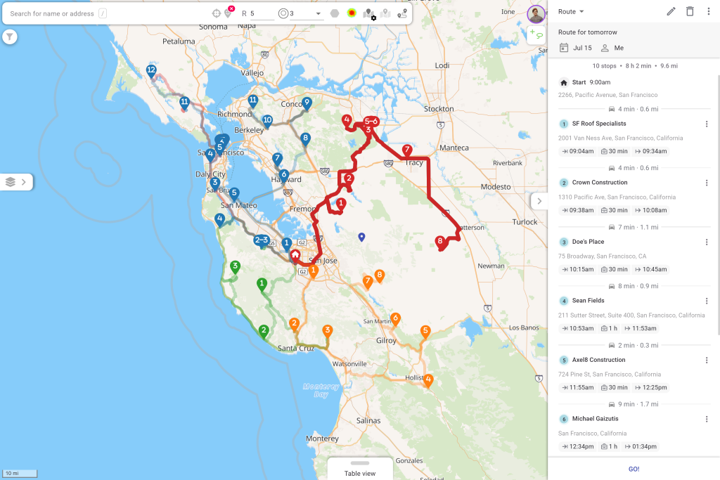
Airtable 데이터에서 최적화된 경로 계획
이 부분은 Airtable이 전혀 할 수 없는 기능입니다. 방문하려는 레코드를 선택하면 (지도 라소, 필터 또는 레코드 한 번 클릭으로), Mapsly가 실시간 및 과거 교통 정보를 사용해 가장 효율적인 경로로 순서를 정합니다.
전체 팀 계획. 전체 현장 팀을 위한 다일간, 다중 사용자 경로.
현실 세계의 제약. 시간대, 영업시간, 작업 소요 시간, 필요한 스킬, 차량 제한.
모든 이동 모드. 자동차, 트럭, 자전거 및 도보, 트럭 제한 사항을 통해 운전자가 부적합한 도로를 이용하지 않도록 합니다.
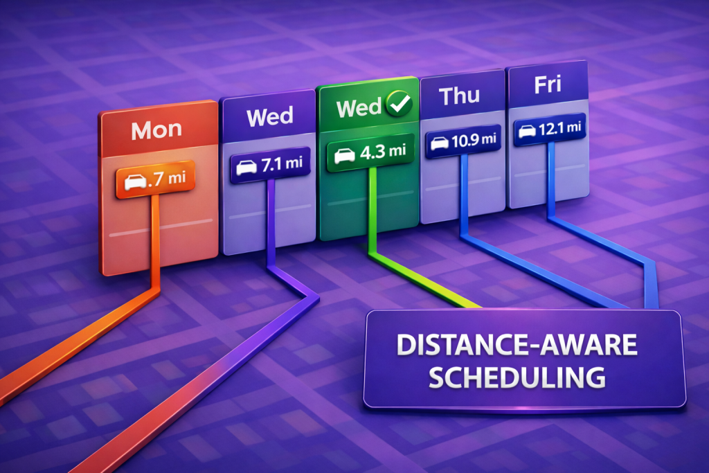
장거리 및 캘린더 인식. 야간 휴식이 포함된 경로, 및 CRM, Google Calendar 또는 Outlook의 기존 회의에 맞춰 배치되는 새 방문.
Airtable 베이스에서 담당 구역 관리
지도에서 구역을 그리거나 가져온 다음, Mapsly가 Airtable 레코드와 담당자를 적절한 영역에 자동으로 할당하도록 하세요. 베이스가 변경되면 할당도 따라 업데이트되어, 수동 정렬 없이도 커버리지가 균형 있게 유지됩니다.
현장 업무 자동화, 코드 없이
Mapsly에는 현장에서 발생하는 상황에 반응하는 노코드 자동화 제품군이 포함되어 있습니다. 체크인, 양식 제출 또는 Airtable 필드 변경 시 워크플로를 트리거한 다음 레코드를 업데이트하고, 관리자에게 알리거나, 다음 단계를 자동으로 실행하세요. 개발자가 필요하지 않습니다.
현장으로 가져가세요
Mapsly의 모바일 앱은 계획을 실행으로 전환합니다. 담당자는 최적화된 경로를 따라 이동하고, 방문 지점에서 체크인 및 체크아웃하며, 구성 가능한 양식으로 필요한 데이터를 정확히 수집합니다. 기록한 내용은 실시간으로 본부에 다시 전달되고, 관리자는 실시간 위치와 계획-vs-실제 성과를 확인할 수 있습니다.
Airtable과 Mapsly가 동기화 상태를 유지하는 방식
Mapsly는 Airtable 테이블과 필드를 복제하며, 새로 생성되거나 업데이트된 레코드는 Airtable에서 실시간으로 가져옵니다. 현장에서 이루어진 변경 사항은 베이스에 다시 기록되므로, 지도와 경로는 항상 테이블에 실제로 있는 내용을 반영합니다. Airtable은 계속해서 신뢰할 수 있는 원본 데이터 소스로 유지되며; Mapsly는 그 주변의 지리 및 현장 실행 레이어입니다.
Airtable 데이터를 지도에 표시하는 방법
1. 연결. Airtable 베이스를 Mapsly에 연결하세요. Mapsly가 테이블과 필드를 몇 분 안에 복제합니다.
2. 지도. Mapsly가 주소를 자동으로 정리하고 지오코딩한 다음, 레코드를 지도에 표시합니다.
3. 경로. 레코드를 선택하고 첫 번째 최적화된 경로를 만드세요.
4. 확장. 구역을 그리고, 체크인 양식을 설정하고, 진행하면서 자동화를 추가하세요.
FAQ
Airtable에 지도 보기가 있나요?
예. Airtable에는 자체 Google Maps API 키를 사용하여 레코드를 핀으로 표시하는 기본 Map 확장 기능이 있습니다. 하지만 보기 전용입니다: 경로를 최적화하거나, 구역을 관리하거나, 변경 사항을 동기화하지 않습니다. 이를 위해서는 Mapsly와 같은 매핑 레이어가 필요합니다.
Airtable 데이터를 Google Maps에 표시할 수 있나요?
주소를 Google Maps에 수동으로 복사할 수 있지만, 약 10개 경유지로 제한되고, 현장 업무 하루 전체를 최적화하지 못하며, 베이스와 동기화된 상태로 유지되지 않습니다. Mapsly는 Airtable 레코드를 직접 지도에 표시하고 실시간으로 최신 상태를 유지합니다.
Airtable에서 경로를 계획할 수 있나요?
예. Mapsly를 사용하면 실시간 교통 정보, 시간대, 기술 또는 차량 제약 조건을 고려하여 Airtable 레코드에서 바로 최적화된 다중 경유지, 다일 경로를 만들 수 있습니다.
Airtable에는 기본 제공 경로 최적화 기능이 있나요?
아니요. Airtable의 기본 지도는 핀만 표시합니다. 경로 최적화에는 Mapsly와 같은 외부 레이어가 필요하며, 이를 코드 없이 추가할 수 있습니다.
Airtable 데이터를 자동으로 지도에 표시하려면 어떻게 해야 하나요?
Airtable 베이스를 Mapsly에 연결하면 테이블과 필드가 복제된 후 주소가 정리되고 지오코딩되며, 일반적으로 몇 분 내에 레코드가 대화형 지도에 표시됩니다.
Mapsly의 Airtable 통합은 노코드인가요?
예. Airtable 연결, 레코드 매핑, 경로 작성, 자동화 설정은 모두 코드를 전혀 작성하지 않고 이루어집니다.
자신의 Airtable 데이터로 확인해 보시겠습니까? 빠른 세션 예약 저희 솔루션 엔지니어와.