


| 기능 |
|
|
|---|---|---|
| 데이터 소스 및 동기화 | ✅실시간 양방향 동기화를 지원하는 네이티브 커넥터; API, CSV 가져오기 및 스프레드시트 업로드도 지원 | ⚠️스프레드시트 형식 위치 데이터 복사/붙여넣기/가져오기; 웹 페이지에 지도 저장 + 공유; 쌍방향 CRM 동기화 도구로 포지셔닝되지 않음 |
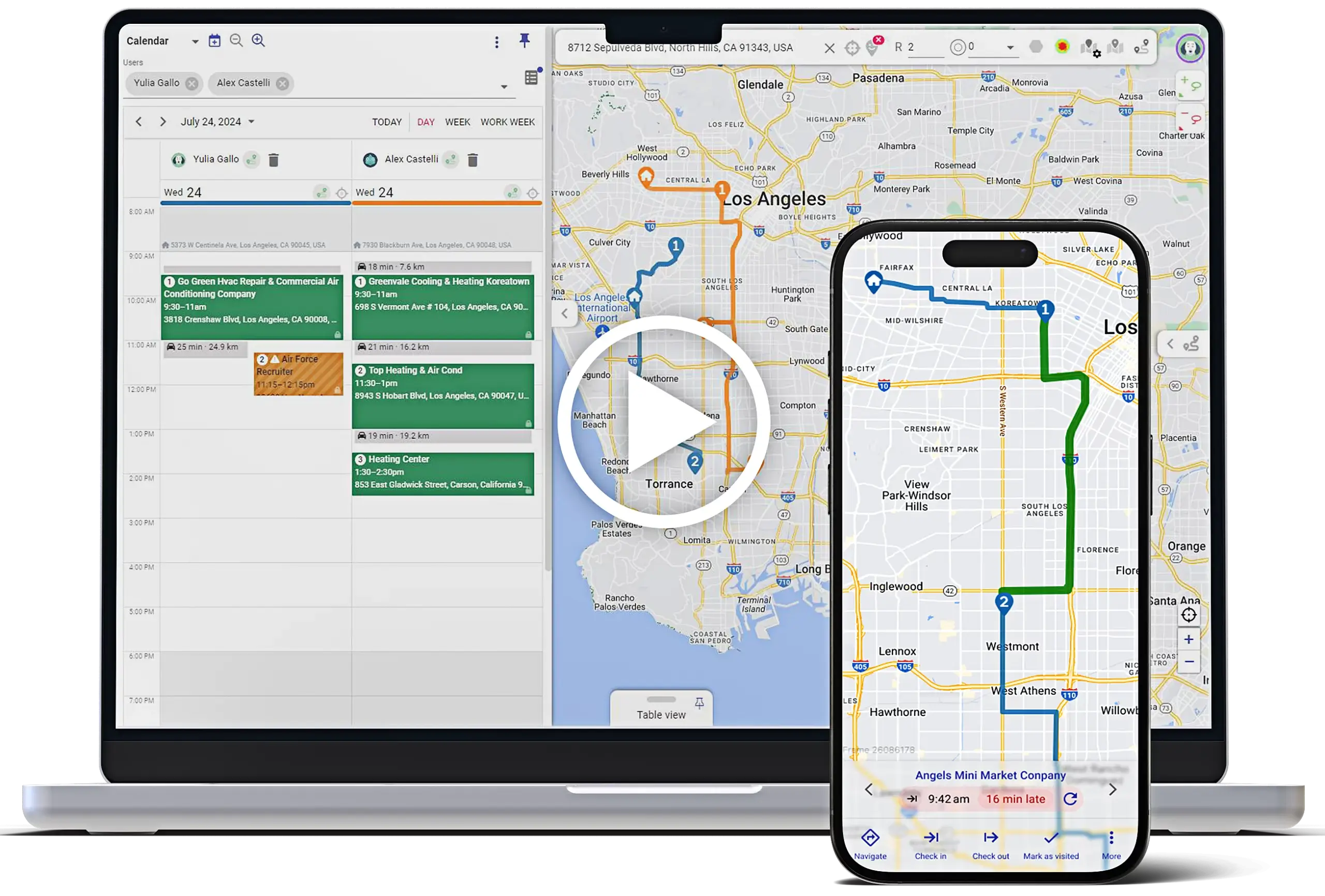
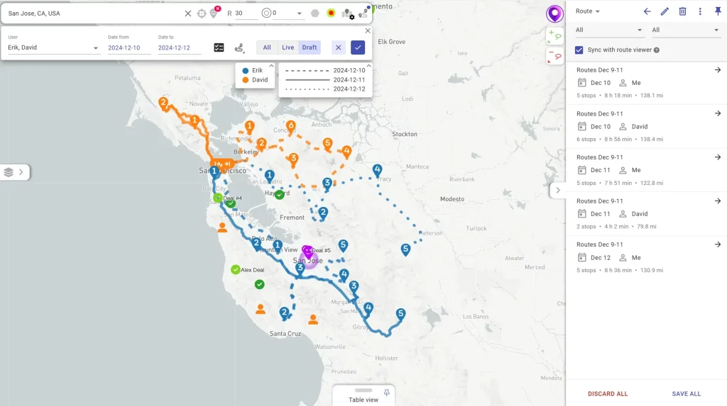
| 라우팅 | ✅최적화된 라우팅에는 다일/팀 라우팅 및 운영 제약 조건이 포함되어 있습니다; Pro 플랜에는 제약 조건이 있는 다중 사용자/일 라우팅과 최적화된 경로에서 최대 1000개의 정류장이 포함되어 있습니다 | ⚠️간단한 매개변수를 사용한 25포인트 경로 최적화(Pro) |
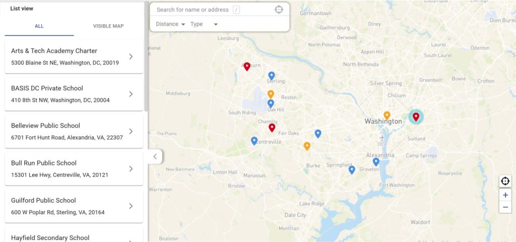
| 영역 | ✅영역을 그리고 자동 할당; 지표 집계; CRM 데이터와 연동된 영역 자동화 | ✅영업 구역 매핑은 핵심 사용 사례입니다; 자동 구역 할당 및 밀도 분석 |
| 모바일 및 오프라인 | ✅오프라인 지원과 함께 iOS 및 Android에서 사용 가능 | ⛔iOS 앱 전용 |
| 체크인 / 작업 증명 | ✅지오펜싱이 가능한 구성형 모바일 체크인; 사진/전자서명과 같은 방문 데이터 캡처 지원(및 CRM/데이터 소스 동기화) | ⛔체크인/체크아웃 기능 없음 |
| 자동화 및 워크플로 | ✅CRM 및 기타 시스템에 걸쳐 확장할 수 있는 전용 노코드/로우코드 자동화 플랫폼(버튼, 워크플로, 행동) | ⛔워크플로 자동화 없음 |
| 공유 및 보안 | ✅실시간 지도 공유 및 삽입; 세분화된 액세스 제어(“누가 무엇을 보는지 제어”) | ✅공개 공유 가능; Pro는 비밀번호 보호를 추가합니다 |
| 분석 | ✅현장 성과 분석 + Mapsly Analytics 애드온(대시보드/지표) | ⛔현장 실행 KPI 없음(지도 시각화만 가능) |
| 주요 사용 사례 | CRM 위에 구축된 현장 영업/서비스 실행 계층(경로 지정 + 영토 관리 + 자동화 + 모바일 워크플로우) | 스프레드시트 → 시각화, 분석, 공유를 위한 대화형 지도; Pro는 경로 최적화 및 보안/내보내기 기능을 추가합니다 |


Mapsly는 현장 생산성을 3배로 늘리면서 연간 50만 달러 이상을 절감하는 데 도움이 되었습니다.

모든 것을 추적할 수 있습니다. 방문 빈도, 연락처 정보 업데이트, 캠페인 도달 범위. 스프레드시트를 뒤질 필요 없이 자동 알림을 받습니다.
우리는 더 이상 지침을 작성할 필요가 없습니다. 상인이 투어를 열 때 이미 시스템에 있습니다.