


| 功能 |
|
|
|---|---|---|
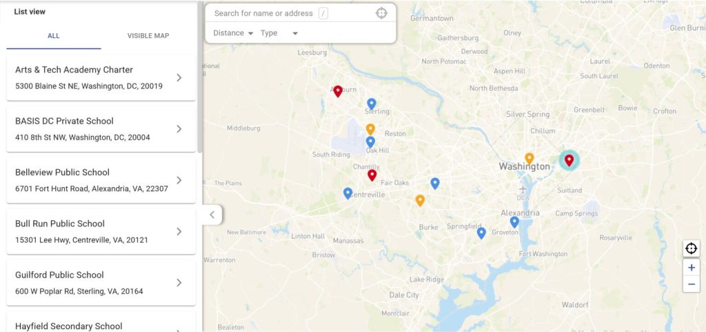
| 数据源与同步 | ✅支持实时双向同步的本地连接器;还支持 API、CSV 导入和电子表格上传 | ⚠️复制/粘贴/导入电子表格样式的位置数据;将地图保存到网页+共享;不定位为双向CRM同步工具 |
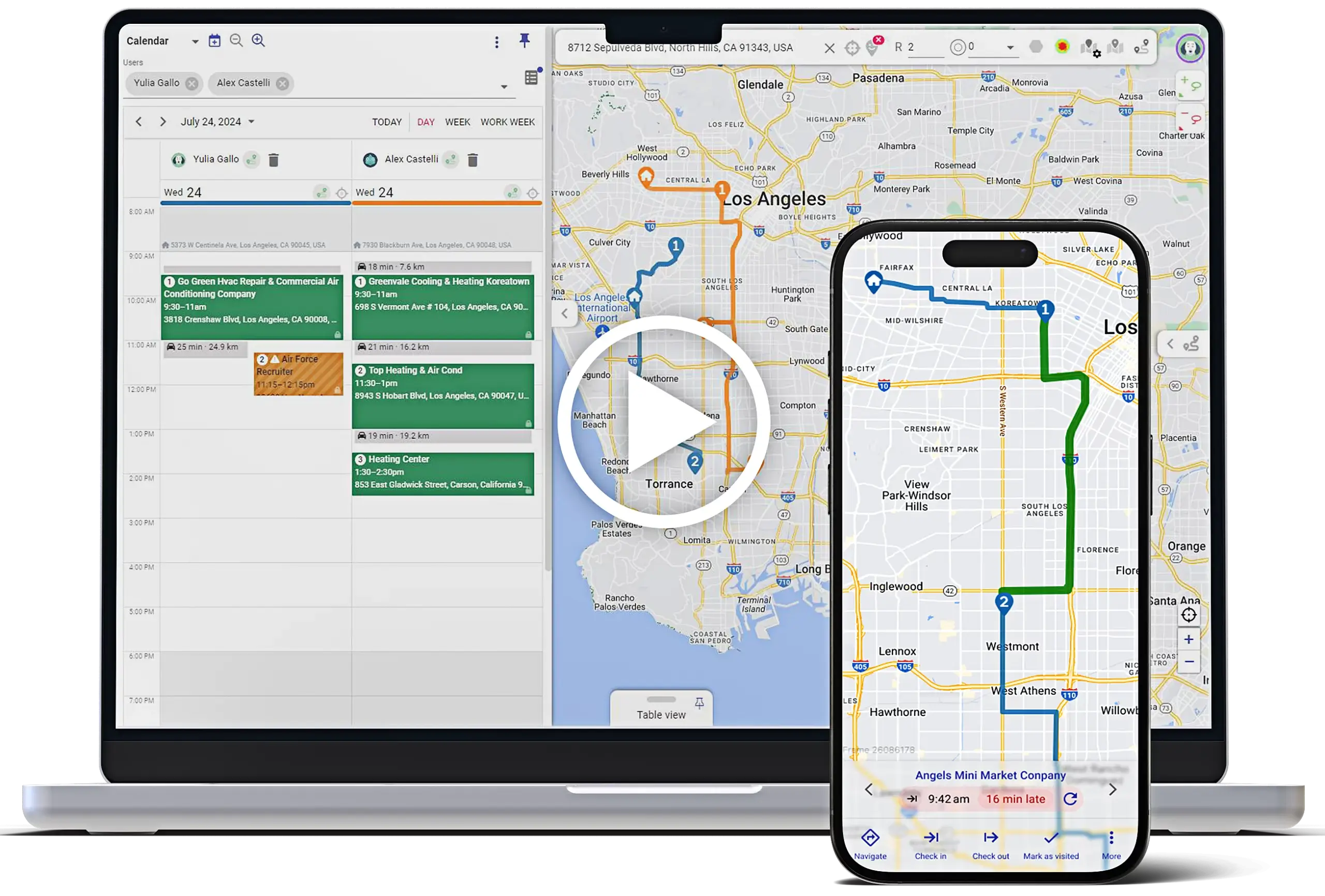
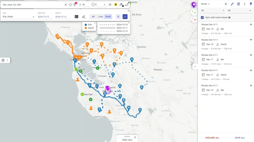
| 路线规划 | ✅优化的路线规划包括多天/团队路线规划和运营约束;Pro 计划包括带约束的多用户/每天路由,优化路线最多支持 1000 个停靠点。 | ⚠️25点路线优化(Pro),参数简单 |
| 领土 | ✅绘制并自动分配区域;汇总指标;与CRM数据绑定的区域自动化 | ✅销售区域映射是核心使用案例;自动化区域分配和密度分析 |
| 移动和离线 | ✅适用于 iOS 和 Android,并支持离线使用 | ⛔仅限 iOS 应用 |
| 签到 / 工作证明 | ✅可配置的移动签到,支持地理围栏;支持捕获访问数据,如照片/电子签名(并同步至CRM/数据源) | ⛔无签到/签退功能 |
| 自动化与工作流程 | ✅专用无代码/低代码自动化平台(按钮、工作流、操作),可涵盖CRM及其他系统和多语言 | ⛔无工作流自动化 |
| 共享与安全 | ✅共享并嵌入实时地图;细粒度访问控制(“控制谁能看到什么”) | ✅支持公开分享;Pro 增加密码保护 |
| 分析 | ✅现场绩效分析 + Mapsly Analytics 附加组件(仪表盘/指标) | ⛔无现场执行关键绩效指标(仅地图可视化) |
| 主要用例 | CRM之上的现场销售/服务执行层(路线规划 + 领地管理 + 自动化 + 移动工作流) | 电子表格 → 用于可视化、分析和共享的交互式地图;Pro 增加了路径优化和安全/导出功能 |


Mapsly 帮助我们将现场生产率提高了三倍,同时每年节省超过 $500K。

我可以追踪一切。访问频率、联系方式更新、活动覆盖范围。我会收到自动通知,而不必再查找电子表格。
我们不需要再编写指令了。当商家开启游览时,系统中已经有了它们。